
Cities are known to be "hotter" than the surrounding countryside and this effect is increased by climate change. It affects more than 50% of the human population - worldwide.
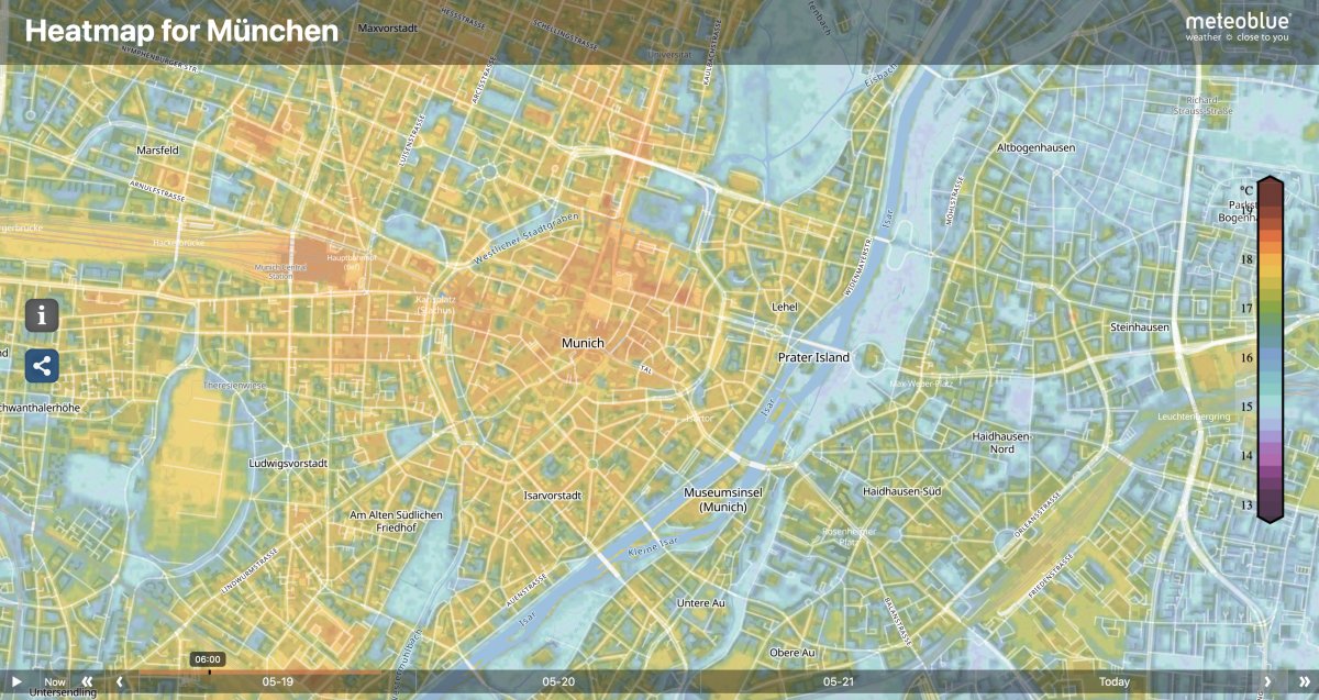
Our new website feature "heat maps" is free of charge and show the actual temperatures "at your doorstep" in 10x10 meters resolution plus a 3-day history for 77 cities and their surrounding areas - worldwide. The city climate overview map shows all cities for which heat maps are currently available. Click one of the orange dots to view the corresponding city’s hyper-local temperature weather map. The underlying data have a uniquely precise spatial resolution of 10x10 meters, showing local temperature patterns within the city, such as heat islands or cool spots. The sample heat maps in this article show Munich and Paris, where you can detect temperatures for each street canyon, park, crossroad or doorstep. Temperature differences of up to 10°C within only a few meters are possible during extremely hot days, calm weather and nights. You can find the heat maps in the navigation under the product section as part of our city climate offer.
Urban areas generally warm up faster than the surrounding area due to the higher degree of sealed surfaces, dense development, and other anthropogenic factors. These factors lead to the so-called “urban heat island effect” which will intensify in the future due to climate change and endanger the health and life of vulnerable citizens.
Air temperature maps show hotspots and cooler locations in the city in real-time and can help citizens to find the city's coolest locations during intense heat waves.
Besides helping citizens in their daily life during heat or cold waves to find the most comfortable spots, our heat maps also create awareness for the well-explored urban heat island effect. The heat maps also help city administrations with the first steps to identify and localise heat islands and plan climate-friendly adaption strategies. More information about our offer for cities can be found on our city climate product pages.
If you would like your city to be listed, please let us know.
