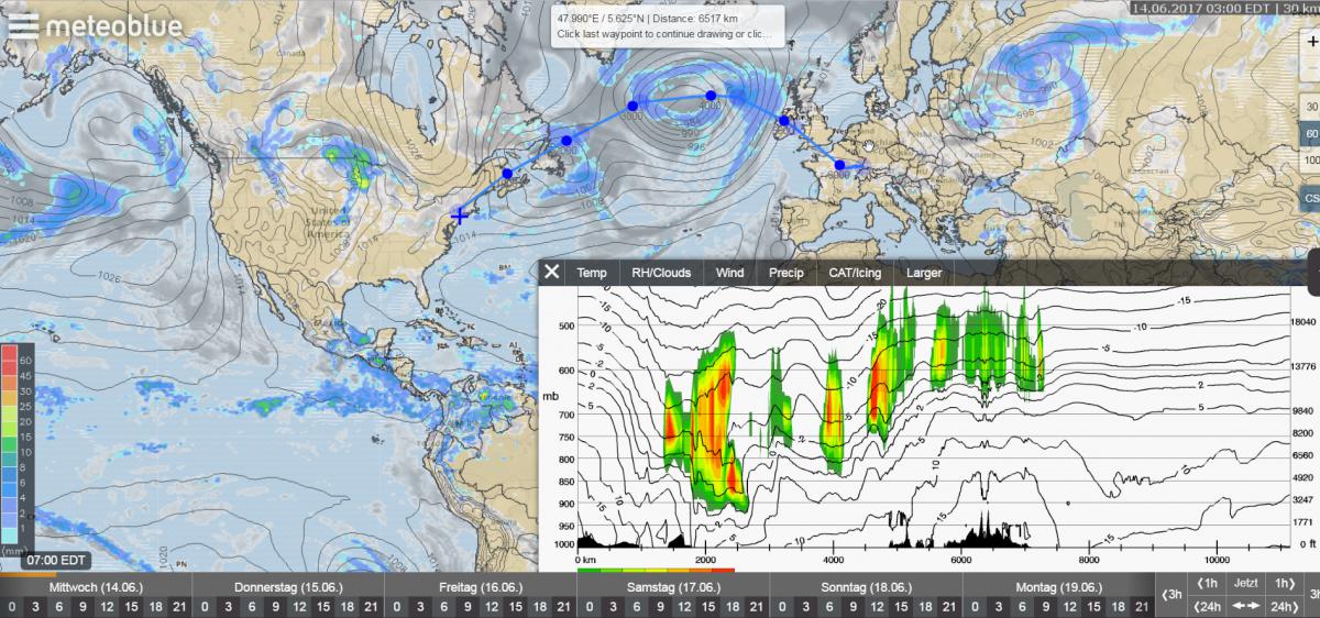
How do I fly to Vienna? Is it cloudy on my flight altitude?
Do I have to deal with a lot of headwind? These and many other questions can be answered using the new Path-Cross section, which is particularly suitable for pilots, as well as for meteorology enthusiasts.
Using this unique feature, it is now possible to generate the vertical cross-section of the atmosphere, for customized routes - worldwide.
As a result, weather-dependent routes can be planned faster and easier than before. The operation is simple: After selection of the CS button on the right side of meteoblue weather maps, you can select places with individual clicks on the world map, which are then automatically aggregated into a route. From the selected route a graph will be generated within seconds, showing all important weather data, like temperature, wind, precipitation, humidity and clouds. In-flight icing conditions can be shown in a separate graph. The comprehensive weather data on the map can thus be viewed with altitude-specific weather data from different altitudes and included in route planning. This function is available free of charge for the current weather situation, as well as in hourly steps over the next 4 days for all point+ subscribers.
