
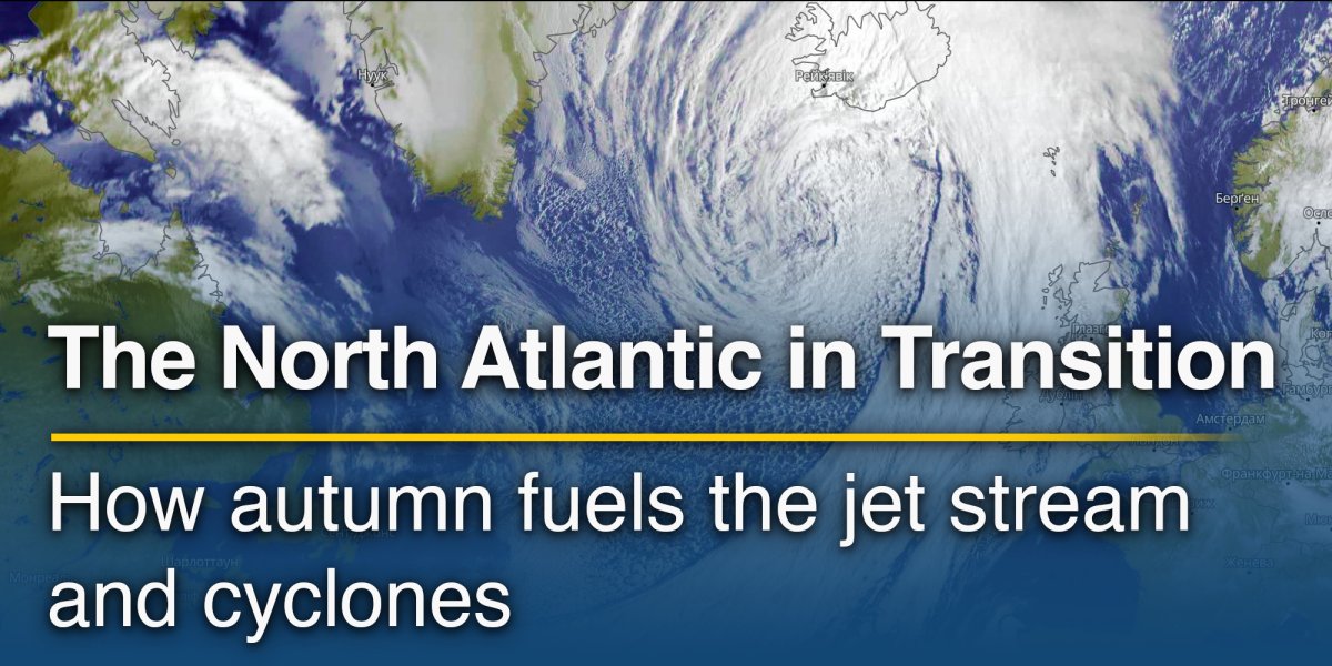
The transition is visible at the surface through shorter days, cooler nights and the first incursions of colder air, but some of the most important changes occur several kilometres above the ground. Across the North Atlantic, the large-scale circulation gradually shifts towards a more energetic cool-season pattern, with the jet stream exerting greater influence on the low-pressure systems, fronts and changing air masses that shape European autumn weather.
This does not mean that storms begin on a particular date, nor does every autumn follow the same progression. Strong Atlantic activity can alternate with blocking highs and settled periods, yet the background environment generally becomes more favourable for active mid-latitude weather as the temperature difference between northern and southern latitudes grows.
A growing temperature contrast across the hemisphere
During Northern Hemisphere summer, high latitudes receive long hours of daylight and the Arctic warms considerably, reducing the temperature difference between polar and subtropical regions. As daylight decreases rapidly in autumn, northern regions lose heat faster, while subtropical areas and the oceans retain more of their summer warmth.
The result is a strengthening north-south, or meridional, temperature gradient. This is fundamental to mid-latitude atmospheric dynamics because temperature differences affect the thickness of atmospheric layers and, through the thermal-wind relationship, the change in wind speed with altitude.
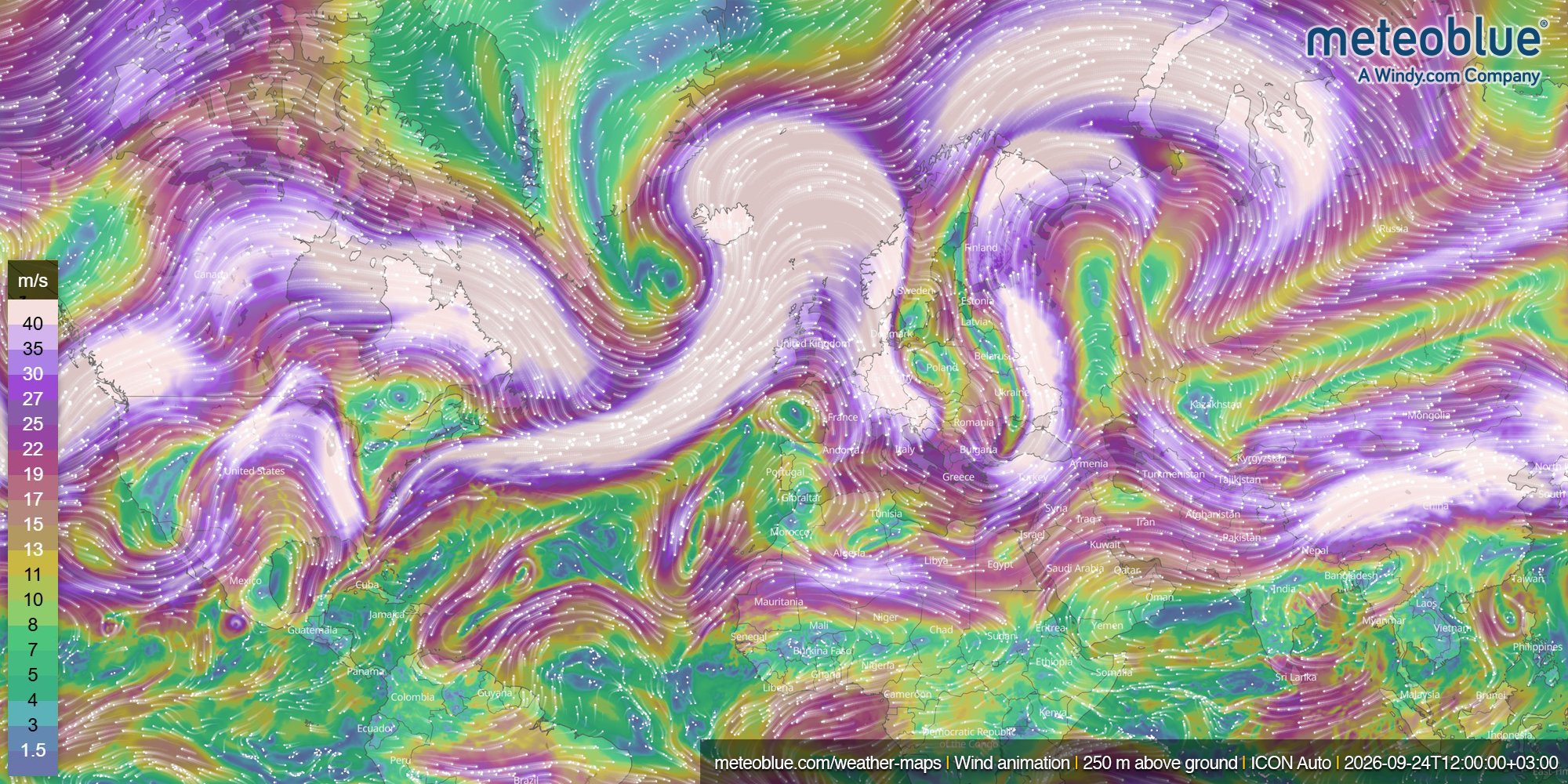
As the horizontal temperature gradient strengthens, vertical wind shear increases and the westerly flow in the upper troposphere can intensify. Near the tropopause, usually around 9–12 kilometres above the surface, this concentrated band of strong winds forms the polar-front jet stream.
This seasonal strengthening is closely connected to the tendency for the jet stream to become faster and more active during the colder part of the year. The change develops gradually, which is why September and October can combine lingering summer-like patterns with increasingly vigorous Atlantic circulation.
Temperature gradients and Atlantic cyclones
The same temperature contrasts that support the jet stream also provide an important source of energy for extratropical cyclones, the low-pressure systems responsible for much of Europe's changeable autumn and winter weather.
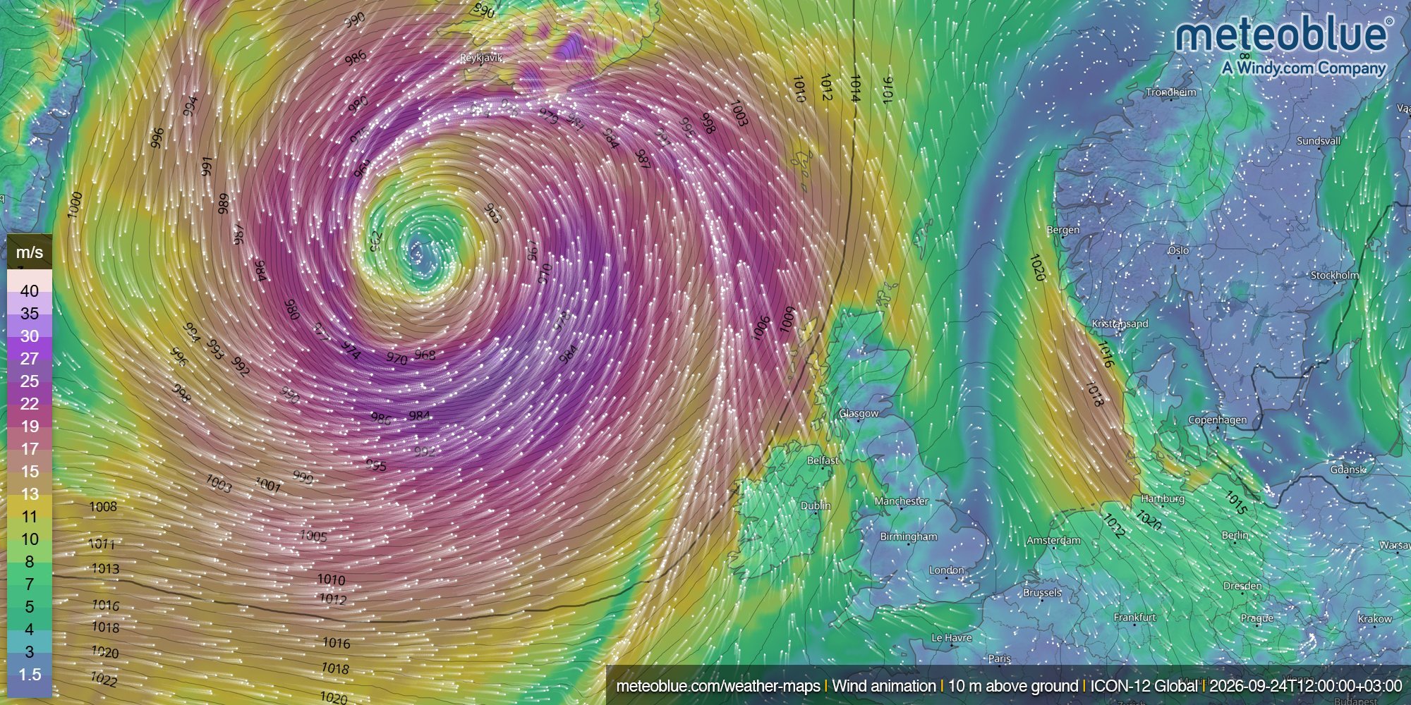
These cyclones develop in a baroclinic atmosphere, where surfaces of constant pressure and constant temperature are not aligned. In practice, strong horizontal temperature differences occur along boundaries separating relatively warm subtropical air from colder polar air. Small disturbances along these boundaries can grow through baroclinic instability. Warm air moves poleward and rises while colder air moves equatorward, amplifying a wave in the atmospheric flow; under favourable conditions, surface pressure falls, fronts become more organised and a developing depression can mature into an Atlantic cyclone.
Through this process, the atmosphere redistributes heat between low and high latitudes while converting part of the potential energy associated with the temperature contrast into the kinetic energy of winds and weather systems. This is why strong temperature gradients and active storm tracks are closely related.
The North Atlantic provides a favourable environment for these processes, particularly as the circulation shifts into its autumn configuration.
The jet stream does more than steer weather systems
The jet stream is often described as a conveyor belt guiding Atlantic weather systems towards Europe, but its role extends beyond steering. Its structure can also influence whether a low-pressure system intensifies, weakens or changes trajectory.
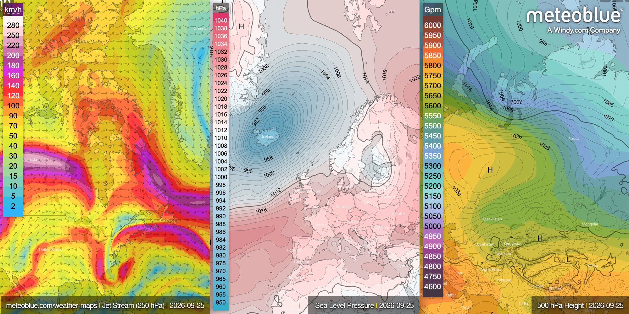
Areas of especially high wind speed within the jet are known as jet streaks. Their associated patterns of convergence and divergence in the upper atmosphere can affect pressure development below, and strong divergence aloft can support the deepening of a surface cyclone when the surrounding synoptic pattern is favourable.
Meteorologists therefore examine more than maximum wind speed on a jet-stream map. The jet's latitude, orientation and curvature, the position of upper-level troughs and their relationship with surface pressure systems all contribute to the forecast.
The meteoblue Weather Maps provide this vertical perspective through synoptic layers including sea-level pressure, 500 hPa geopotential height and the Jet Stream at 250 hPa, allowing upper-level circulation to be compared directly with weather systems closer to the surface.
Why the North Atlantic is especially dynamic in autumn
Autumn brings together two seasonal developments that are especially relevant over the Atlantic: high-latitude air becomes progressively colder, increasing the atmospheric temperature gradient, while the ocean retains much of the heat accumulated during summer because seawater cools more slowly than land.
When colder air from North America moves over the relatively warm western Atlantic, the contrast between the two can strengthen the exchange of heat and moisture between the ocean and atmosphere. Together with strong upper-level winds, this can create favourable conditions for low-pressure systems to form and intensify as they move northeast across the Atlantic.
As the season progresses, the storm track typically becomes more prominent, increasing the likelihood of frontal passages, strong winds and rapidly changing weather in parts of western and northern Europe. A more mobile circulation may bring mild southwesterly air ahead of a low, followed by a cold front and cooler maritime air from the northwest before the next ridge or depression arrives.
This sequence of changing air masses is characteristic of European autumn weather and reflects an active atmospheric circulation across the mid-latitudes.
A stronger jet does not necessarily mean stormier weather everywhere
Although the jet stream generally strengthens as the temperature contrast between low and high latitudes increases, its position and shape are just as important as its speed. A strong jet directed towards the British Isles and northern Europe can guide repeated Atlantic depressions and fronts into the region. If the jet shifts farther north, central and southern Europe may remain under higher pressure, while a southward shift of the jet can steer more low-pressure systems towards Iberia or the Mediterranean.
The jet can also become highly amplified, developing pronounced north-south waves instead of a relatively straight west-to-east path. Such patterns may support persistent ridges and troughs, allowing weather regimes to remain in place for longer.
How active the Atlantic becomes from week to week also depends on broader circulation patterns such as the North Atlantic Oscillation (NAO), which can influence the strength and position of the Atlantic westerlies and storm track. This helps explain why autumn can alternate between relatively settled periods and periods of increased Atlantic storm activity.
When tropical and mid-latitude weather systems meet
Early autumn also overlaps with the active part of the Atlantic hurricane season. Tropical cyclones that recurve northwards can leave the warm tropical environment and encounter stronger temperature gradients, cooler waters and the mid-latitude jet stream. During extratropical transition, a tropical cyclone gradually loses its tropical characteristics and develops into an extratropical cyclone within the mid-latitude circulation. It can then move across the North Atlantic, sometimes interacting with the jet stream and influencing weather farther east.
These interactions matter for medium-range forecasting because disturbances far to the west can modify the jet stream and influence European weather several days later. The North Atlantic is therefore best viewed as one connected atmospheric system rather than a sequence of isolated storms.

Reading the autumn atmosphere from several levels
This seasonal transition becomes clearer when several atmospheric levels are considered together rather than focusing only on the surface. Sea-level pressure shows cyclones and anticyclones, while temperatures and winds around 850 hPa reveal the distribution and movement of major air masses. At 500 hPa, geopotential-height maps show the large-scale troughs and ridges embedded in the flow, while maps around 250–300 hPa reveal the strongest upper-level winds and the broader jet-stream circulation that helps steer and influence developing weather systems.
Together, these maps provide a broader picture of North Atlantic weather. In the meteoblue Synoptic Charts, users can follow pressure systems, geopotential heights and upper-level winds over the coming days and see how different levels of the atmosphere interact.
Autumn as a transition, not a switch
The increasing activity of the North Atlantic during autumn is best understood as a gradual shift in the atmospheric energy balance. As polar regions cool, the mid-latitude temperature contrast strengthens, upper-level westerlies become more prominent and conditions become more favourable for cyclone development.
The exact configuration of the jet stream remains highly variable, influenced by atmospheric waves, ocean conditions, the NAO and individual weather systems. Some autumn periods can remain remarkably settled, while others bring a rapid succession of Atlantic lows.
Autumn is therefore a period of transition, as the North Atlantic slowly moves towards its winter circulation.
For further discussion and observations on this topic, visit the meteoblue Community Forum, where our experts and community members share insights and experiences.


