meteoblue Urban Maps bieden hogeresolutie-visualisaties van belangrijke stedelijke weer- en klimaatpatronen, waaronder temperatuur, wind, thermisch comfort en het risico op pluviale overstromingen. Ontworpen voor stedelijke omgevingen helpen de kaarten bewoners, planners en besluitvormers lokale omstandigheden beter te begrijpen en zich voor te bereiden op hitte, windexpositie en de gevolgen van zware regenval.
Stedelijk weer beïnvloedt het dagelijks leven
Steden creëren hun eigen microklimaten. Gebouwen, wegen, groene ruimten, wateroppervlakken en terrein beïnvloeden allemaal hoe warmte zich ophoopt, hoe wind door straten beweegt en hoe regenval buurten treft.
Naarmate steden blijven groeien en extreme weersomstandigheden vaker voorkomen, is inzicht in deze lokale verschillen essentieel. Eén stad kan koelere schaduwrijke gebieden, blootgestelde hotspots, windcorridors en zones die gevoeliger zijn voor hevige regenval bevatten. Urban Maps maken deze patronen zichtbaar.
Met gedetailleerde meteorologische modellering en hogeresolutie-visualisatie ondersteunen meteoblue Urban Maps beter geïnformeerde beslissingen voor klimaatadaptatie, volksgezondheid, stadsplanning en het dagelijks stadsleven.
Naast de luchttemperatuur kunnen Urban Maps windcondities, de Physiological Equivalent Temperature (PET) en informatie over pluviale overstromingen weergeven. Dit bredere perspectief helpt steden niet alleen te begrijpen waar het heet is, maar ook hoe buitenscomfort, ventilatie en regenvalgerelateerde risico's per straat, wijk en openbare ruimte verschillen.
De impact van hittegolven neemt snel toe
Het snel toenemende aantal hittegerelateerde sterfgevallen illustreert op dramatische wijze hoe het delicate evenwicht in landgebruik een urgent vraagstuk is geworden, vooral nu stedelijke gebieden blijven uitbreiden en dagelijks meer mensen van het platteland naar de stad verhuizen. Hittegolven behoren tot de gevaarlijkste natuurrampen en vooral kwetsbare groepen moeten worden beschermd tegen hittestress.
De meteoblue Urban Maps bieden hyperlokale voorspellingen die specifiek zijn ontwikkeld voor stedelijke omgevingen en geven zowel bewoners als stadsplanners de middelen om de impact van klimaatmitigatiemaatregelen te beoordelen, zoals de gerichte introductie van groene ruimten in een stedelijke omgeving.
Onze temperatuurkaarten laten zien waar kleine veranderingen een groot verschil kunnen maken. Door gedetailleerde meteorologische inzichten en voorspellingen te bieden, stellen de meteoblue Urban Maps stedelijke ontwikkelaars, bedrijven en bewoners in staat weloverwogen beslissingen te nemen voor een hogere levenskwaliteit in de stad. Dergelijke gerichte acties dragen bij aan een comfortabelere en duurzamere stedelijke toekomst en helpen stedelijke gemeenschappen te floreren ondanks een veranderend klimaat.
Global Heat Monitor - Vroegtijdige detectie van aankomende hittegolven voor steden wereldwijd
Staat uw gewenste stad er niet bij? Geen probleem: nieuwe steden kunnen binnen enkele dagen aan de interface worden toegevoegd. Neem contact met ons op en onze experts nemen spoedig contact met u op. Zodra de stad is toegevoegd, kan de resulterende kaartwidget binnen enkele minuten in websites en applicaties worden geïntegreerd.
Meer informatieHoe herkent u de symptomen van hittestress
Hitte-uitputting
- Flauwte of duizeligheid
- Overmatig zweten
- Koele, bleke, klamme huid
- Misselijkheid of braken
- Snelle, zwakke pols
- Spierkrampen
Om hitte-uitputting te voorkomen, raadpleegt u de hieronder aanbevolen maatregelen.
Hitteberoerte
- Bonzende hoofdpijn
- Geen zweten
- Hoge lichaamstemperatuur
- Rode, hete, droge huid
- Misselijkheid of braken
- Snelle, sterke pols
- Kan het bewustzijn verliezen
Hitteberoerte is een levensbedreigende aandoening: zoek onmiddellijk medische hulp of bel uw lokale alarmnummer!
Hoe uzelf en anderen te beschermen tegen hittestress
Zorg voor een constante voorraad drinkwater en vergeet niet regelmatig te drinken. Moedig anderen aan hetzelfde te doen.
Blijf binnen of in schaduwrijke, goed geventileerde ruimtes. Draag lichtgewicht, lichtgekleurde kleding en vermijd buitenactiviteiten rond het middaguur.
Houd overdag ramen en jaloezieën gesloten en ventileer ’s nachts. Neem koele douches of maak uw huid nat met een vochtig doekje om het comfort te vergroten.
Plan activiteiten op de koelste momenten van de dag en vermijd inspanning in de hitte.
Let op kwetsbare groepen zoals jonge kinderen, ouderen, zwangere vrouwen en mensen met medische aandoeningen. Wees alert op symptomen van door hitte veroorzaakte ziektes.

Temperatuurkaarten bij u in de buurt
meteoblue Urban Maps zijn beschikbaar voor geselecteerde steden en kunnen worden uitgebreid naar nieuwe locaties. De kaarten kunnen in websites en applicaties worden geïntegreerd, zodat steden, organisaties en bewoners via een intuïtief visueel formaat toegang hebben tot gedetailleerde lokale informatie. Voor steden met lokale meetnetwerken kunnen modelgegevens worden vergeleken met grondwaarnemingen om de nauwkeurigheid te verbeteren en de effectiviteit van aanpassingsmaatregelen in de tijd te monitoren.
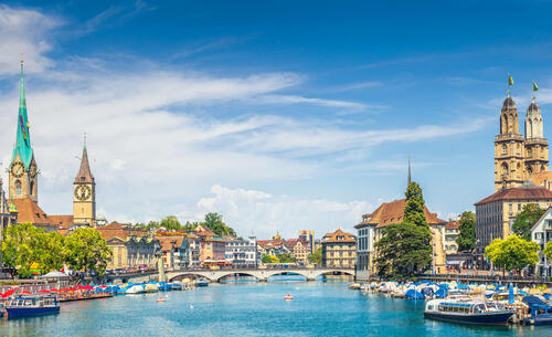
Windkaart - voorbeeld voor Zürich
Stedelijke windkaarten tonen hoe windsnelheid en -richting binnen de stad variëren. Gebouwen, straatcanyons, open ruimten en lokaal terrein kunnen de luchtstroom sterk beïnvloeden, waardoor beschutte zones, ventilatiecorridors of blootgestelde gebieden ontstaan. Deze informatie kan stedelijk ontwerp, planning van openbare ruimten, comfortbeoordelingen, infrastructuurplanning en de evaluatie van de interactie tussen wind, hitte en luchtkwaliteit ondersteunen.
Naast de hogeresolutie-temperatuurweergave kunnen de meteoblue Urban Maps worden uitgebreid met een reeks nuttige functies, waaronder een 7-daagse voorspellingsoptie, een realtime neerslagradaroverlay en de hyperlokale 2 m-windveldanimatie, zoals hierboven getoond aan de hand van de digitale tweeling van de stad Zürich, Zwitserland.
PET-kaarten - voorbeeld voor Zürich
Physiological Equivalent Temperature, of PET, beschrijft hoe weersomstandigheden aanvoelen voor het menselijk lichaam. Het combineert verschillende factoren die het thermisch comfort beïnvloeden, waaronder luchttemperatuur, luchtvochtigheid, wind en straling.
PET-kaarten bieden daarom een mensgerichtere kijk op stedelijke hittestress dan alleen de luchttemperatuur. Ze laten zien waar buitensituaties oncomfortabel of potentieel gevaarlijk kunnen aanvoelen, vooral voor kwetsbare groepen tijdens hitte-evenementen.
Steden met actieve City Climate Monitoring Systems
Urban Maps ondersteunen steden bij het identificeren van lokale klimaatpatronen, het communiceren van risico's en het plannen van gerichte adaptatiemaatregelen. Of de focus nu ligt op hittemitigatie, buitencomfort, windexpositie of regenvalgerelateerde risico's, de kaarten bieden een gedetailleerd ruimtelijk beeld van de omstandigheden die het stadsleven vormgeven.
Dit project heeft financiering ontvangen van het "Horizon 2020 onderzoeks- en innovatieprogramma" van de Europese Unie in het kader van de subsidieovereenkomst 101004112.