The heavy rainfalls in New Zealand over the last few days can be analysed with our radar archive and the forecast for the next days with our precipitation weather maps, as shown in the screenshot.
The precipitation maps give you more detailed information on local precipitation forecasts, for example, predicted hourly and daily precipitation sums. These maps are part of our point+ subscription, which gives you access to high-precision weather information and many meteograms, such as the 7-day meteogram that summarizes the essential weather variables in one simple chart. You can test point+ for 14 days.
The heavy rainfalls in New Zealand are displayed very well. The storm and rain events are driven mainly by the immense high-pressure system east of New Zealand, bringing strong and moist winds, even reaching the tropical zone north of New Zealand. There, these winds hit the low-pressure front located northwest of New Zealand. The result is a moist, atmospherical flow moving to the south directly towards the northern peninsula of New Zealand, as highlighted in the screenshot taken on 2023-01-30.

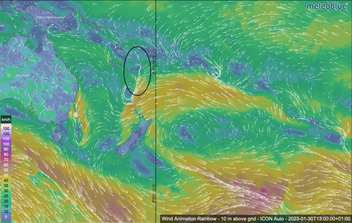
While the high-pressure system varied in size during the last days, the front west of New Zealand was pushed back and forth, which explains why the rain events hit New Zealand rather discontinuously.
We recommend looking at our precipitation radar to track the local weather in real time. It shows the most recent cloud movements and precipitation in the highest resolution. The recording was taken on 2023-01-30, showing the precipitation in New Zealand in 15-minute time steps.

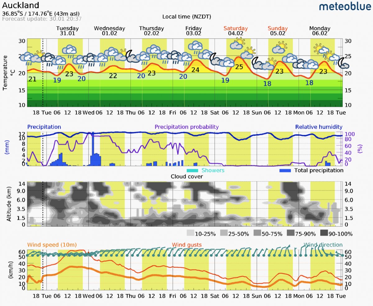
Looking into the future, it is very likely that it will rain again. Heavy rainfall is expected, especially from Tuesday to Wednesday, as seen on our meteogram or precipitation forecast maps. While the rain front will initially affect the far north of New Zealand on Tuesday, it will move over Auckland and the Coromandel Peninsula later and then, slightly softened, continue south towards the Bay of Plenty. The weather warnings issued by the national authorities warn of moderate to heavy rainfall and a moderate risk of severe thunderstorms. However, these storms are expected to weaken eventually from Wednesday onwards.
We are sure that our tools will help you to follow the local weather.
