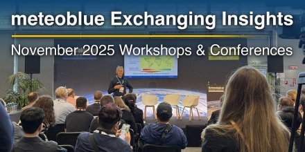
From Water Sports to Wine Tasting: meteoblue Day 2025
At the beginning of July, the meteoblue team gathered for the annual meteoblue day – an offsite filled with nature, laughter and a healthy dose of team spirit.
Urban areas experience more intense heat due to dense infrastructure and limited green space.
|
|||||||||
---|---|---|---|---|---|---|---|---|---|
Icon
|
|
|
|
|
|
|
|
|
|
Temperature (°F)
|
|||||||||
Temperature felt (°F)
|
58° |
58° |
63° |
70° |
73° |
71° |
65° |
62° |
|
Wind direction
|
N |
NNE |
WSW |
WSW |
W |
ENE |
S |
W |
|
Wind speed (mph)
|
N
3-7
3-7
|
NNE
2-5
2-5
|
WSW
2-5
2-5
|
WSW
3-7
3-7
|
W
3-9
3-9
|
ENE
3-9
3-9
|
S
3-5
3-5
|
W
3-8
3-8
|
|
Precipitation (in/3h)
|
-
0%
-
|
-
0%
-
|
-
0%
-
|
-
0%
-
|
-
0%
-
|
-
5%
-
|
< 0.04 in
65%
< 0.04
|
0.12 in
65%
0.12
|
|
Precipitation probability
|
0%
|
0%
|
0%
|
0%
|
0%
|
5%
|
65%
|
65%
|
|
Precipitation hourly
|
|||||||||
rainSPOT
Precipitation distribution within 20 km
|
|
The whole day it is mostly cloudy. The sun will not be visible. With 60% probability of precipitation we are at the upper end of a moderate chance. Temperatures peaking at 74 °F. Overnight into Thursday blows a light breeze (4 to 8 mph). In the course of day light air is noticeable (1 to 4 mph). Winds blowing overnight from North and by day from Southwest. The weather forecast for 50. 67°N 14. 07°E for Thursday is likely to be accurate.
Pressure: 1012 hPa
Timezone: CEST (UTC +02:00h)
The location marker is placed on 50.67°N 14.07°E. This animation shows the precipitation radar for the selected time range, as well as a 2h forecast. Orange crosses indicate lightning. Data provided by nowcast.de (available in USA, Europe, Australia). Drizzle or light snow fall might be invisible for the radar. Precipitation intensity is colour coded, ranging from turquoise to red.
The real-time satellite image combines visible light during daytime with infrared radiation during nighttime. At night, the image is not dark as infrared radiation can detect temperature differences. Unfortunately, low clouds and fog are difficult to distinguish from ground temperatures and thus can be almost invisible during the night. Meteosat satellite images for Europe are updated in real-time every 5 minutes. GOES-16/GOES-17 (North & South America) and Himawari (Asia) images update every 10 minutes.
Precipitation is estimated from radar and satellites. Precipitation estimates from satellites are less accurate at night than during daytime.
© 2025 meteoblue, NOAA Satellites GOES-16 and EUMETSAT. Lightning data provided by nowcast.
At the beginning of July, the meteoblue team gathered for the annual meteoblue day – an offsite filled with nature, laughter and a healthy dose of team spirit.
Urban areas experience more intense heat due to dense infrastructure and limited green space.
Advertising is essential to maintain our free website with unique detail and accuracy.
Please whitelist www.meteoblue.com on your ad blocker or consider buying one of our products:
Already have a subscription?
Then please login.