News

Case Study: High-Resolution Climate Modelling for the Swiss Rail Network
The Challenge: 1960s Infrastructure Standards vs. Future Outlook
Read on

The Challenge: 1960s Infrastructure Standards vs. Future Outlook
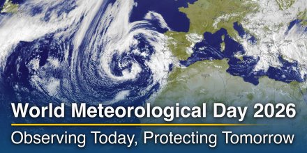
Every year on 23 March, the global meteorological community celebrates World Meteorological Day, recognising the vital role of weather and climate services in society.
|
|
|
|
|
|
|
|
||
|
Icon
|

|

|

|

|
|

|

|
|
|
°F
|
26°
|
25°
|
26°
|
27°
|
27°
|
25°
|
25°
|
24°
|
|
°F
|
18°
|
17°
|
17°
|
18°
|
15°
|
14°
|
16°
|
15°
|
|
|
E |
E |
ESE |
SE |
SSE |
S |
S |
SSW |
|
mph
|
5-18
|
5-18
|
8-24
|
10-26
|
13-27
|
12-31
|
7-25
|
6-18
|
|
in
|
-
|
-
|
-
|
< 0.04
|
0.09
|
0.08
|
< 0.04
|
< 0.04
|
|
%
|
25%
|
30%
|
55%
|
75%
|
85%
|
90%
|
80%
|
80%
|
|
in
|
||||||||
|
12.4 mi
|
Overnight into Wednesday it is mostly cloudy. On Wednesday morning even more clouds and snow are expected. For the afternoon the weather is changing with a mix of clear and cloudy skies and a chance of snow. The sun will not be visible. Precipitation is very likely with an 80% chance. Temperatures peaking at 28 °F. Overnight into Wednesday blows a light breeze (4 to 8 mph). Before noon a gentle breeze is expected (8 to 12 mph). Wednesday afternoon expect a moderate breeze (12 to 18 mph). Gusts to 31 mph are possible. Winds blowing overnight from East, in the morning from Southeast and during the afternoon from South. The weather forecast for Qebleh Dāgh for Wednesday is likely to be accurate.

Pressure: 1002 hPa
Timezone: GMT+0330 (UTC +03:30h)
Overnight into Wednesday it is mostly cloudy. On Wednesday morning even more clouds and snow are expected. For the afternoon the weather is changing with a mix of clear and cloudy skies and a chance of snow. The sun will not be visible. Precipitation is very likely with an 80% chance. Temperatures peaking at 28 °F. Overnight into Wednesday blows a light breeze (4 to 8 mph). Before noon a gentle breeze is expected (8 to 12 mph). Wednesday afternoon expect a moderate breeze (12 to 18 mph). Gusts to 31 mph are possible. Winds blowing overnight from East, in the morning from Southeast and during the afternoon from South. The weather forecast for Qebleh Dāgh for Wednesday is likely to be accurate.
Pressure: 1002 hPa
Timezone: GMT+0330 (UTC +03:30h)
The location marker is placed on Qebleh Dāgh. This animation shows the precipitation radar for the selected time range, as well as a 2h forecast. Orange crosses indicate lightning. Data provided by nowcast.de (available in USA, Europe, Australia). Drizzle or light snow fall might be invisible for the radar. Precipitation intensity is colour coded, ranging from turquoise to red.
You can embed this meteogram into your own website. Customize it here.
The real-time satellite image combines visible light during daytime with infrared radiation during nighttime. At night, the image is not dark as infrared radiation can detect temperature differences. Unfortunately, low clouds and fog are difficult to distinguish from ground temperatures and thus can be almost invisible during the night. Meteosat satellite images for Europe are updated in real-time every 5 minutes. GOES-16/GOES-17 (North & South America) and Himawari (Asia) images update every 10 minutes.
Precipitation is estimated from radar and satellites. Precipitation estimates from satellites are less accurate at night than during daytime.
© 2026 meteoblue, NOAA Satellites GOES-16 and EUMETSAT. Lightning data provided by nowcast.
The Challenge: 1960s Infrastructure Standards vs. Future Outlook
Every year on 23 March, the global meteorological community celebrates World Meteorological Day, recognising the vital role of weather and climate services in society.
Advertising is essential to maintain our free website with unique detail and accuracy.
Please whitelist www.meteoblue.com on your ad blocker or consider buying one of our products:
Already have a subscription?
Then please login.


 Takāb
Takāb 


