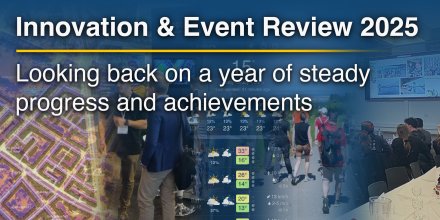
meteoblue Ad-free 9 €
Icon
Partly cloudy and cirrus
Overcast
Overcast with light snow
Mostly cloudy and few cirrus
Overcast
Overcast
Temperature (°F)
10°
10°
10°
10°
11°
11°
11°
11°
12°
12°
12°
12°
Temperature felt (°F)
-11°
-12°
-14°
-14°
-13°
-10°
-9°
-7°
Wind direction
SSE
SSE
SSE
SSE
SSE
SSE
SSE
SSE
Wind speed (mph)
SSE
24-49
24-49
SSE
27-52
27-52
SSE
30-55
30-55
SSE
31-54
31-54
SSE
30-50
30-50
SSE
26-44
26-44
SSE
25-43
25-43
SSE
22-41
22-41
Precipitation (in/3h)
-
0%
-
-
0%
-
-
25%
-
< 0.04 in
35%
< 0.04
< 0.04 in
55%
< 0.04
-
10%
-
-
30%
-
-
30%
-
Precipitation probability
0%
0%
25%
35%
55%
10%
30%
30%
Precipitation hourly

00:00 to 01:00:
0% chance of precipitation in the area.
0″ are predicted by our local models.

01:00 to 02:00:
0% chance of precipitation in the area.
0″ are predicted by our local models.

02:00 to 03:00:
0% chance of precipitation in the area.
0″ are predicted by our local models.

03:00 to 04:00:
0% chance of precipitation in the area.
0″ are predicted by our local models.

04:00 to 05:00:
0% chance of precipitation in the area.
0″ are predicted by our local models.

05:00 to 06:00:
0% chance of precipitation in the area.
0″ are predicted by our local models.

06:00 to 07:00:
0% chance of precipitation in the area.
0″ are predicted by our local models.

07:00 to 08:00:
25% chance of precipitation in the area.
0″ are predicted by our local models.

08:00 to 09:00:
25% chance of precipitation in the area.
0″ are predicted by our local models.

09:00 to 10:00:
25% chance of precipitation in the area.
0″ are predicted by our local models.

10:00 to 11:00:
35% chance of precipitation in the area.
0″ are predicted by our local models.

11:00 to 12:00:
35% chance of precipitation in the area.
0″ are predicted by our local models.

12:00 to 13:00:
55% chance of precipitation in the area.
0″ are predicted by our local models.

13:00 to 14:00:
25% chance of precipitation in the area.
0″ are predicted by our local models.

14:00 to 15:00:
5% chance of precipitation in the area.
0″ are predicted by our local models.

15:00 to 16:00:
0% chance of precipitation in the area.
0″ are predicted by our local models.

16:00 to 17:00:
10% chance of precipitation in the area.
0″ are predicted by our local models.

17:00 to 18:00:
10% chance of precipitation in the area.
0″ are predicted by our local models.

18:00 to 19:00:
30% chance of precipitation in the area.
0″ are predicted by our local models.

19:00 to 20:00:
20% chance of precipitation in the area.
0″ are predicted by our local models.

20:00 to 21:00:
20% chance of precipitation in the area.
0″ are predicted by our local models.

21:00 to 22:00:
20% chance of precipitation in the area.
0″ are predicted by our local models.

22:00 to 23:00:
20% chance of precipitation in the area.
0″ are predicted by our local models.

23:00 to 00:00:
30% chance of precipitation in the area.
0″ are predicted by our local models.

rainSPOT Precipitation distribution within 20 km
1h view
Hourly view
The weather forecast has high predictability. Compare different forecasts with MultiModel.

Weather report for 62°N 9°E

Overnight into Monday it is mostly cloudy. On Monday morning even more clouds and snow are expected. Monday afternoon the sky remains overcast. The sun will not be visible. The chance of precipitation is moderate or near 50%. Temperature highs are likely to reach 12 °F. Until noon a strong breeze is blowing (25 to 32 mph). Monday afternoon winds near gale force (32 to 39 mph). From time to time gusts could reach up to 55 mph. Winds blowing from Southeast. The weather forecast for 62°N 9°E for Monday is likely to be accurate.

sun-icon
UV 0
09:29
15:34
Waning crescent (290°)
03:49
10:36

Pressure: 1013 hPa

Timezone: CET (UTC +01:00h)

Official severe weather warnings

Kraftig snøfokk, gult nivå, Fjellet i Sør-Norge, 2026-01-11T21:00:00+00:00, 2026-01-12T23:00:00+00:00
Moderate
Now
From Sunday 22:00 (7 hours ago)
Until Midnight (18 hours from now)
Blowing snow, yellow level, The mountains in Southern Norway, 2026-01-11T21:00:00+00:00, 2026-01-12T23:00:00+00:00
Moderate
Now
From Sunday 22:00 (7 hours ago)
Until Midnight (18 hours from now)
Last update:
Language:

Storm watch - Wind map

High wind speeds expected for 62°N 9°E. More Weather Maps

The animation shows the wind conditions of the storm at 200m above ground, which corresponds well with expected gusts at the surface. Choose other time steps to see the forecast of the storm.

Weather radar, 62°N 9°E

Drizzle
Light
Moderate
Heavy
Very Heavy
Hail

The location marker is placed on 62°N 9°E. Orange crosses indicate lightning. Data provided by nowcast.de (available in USA, Europe, Australia). Drizzle or light snow fall might be invisible for the radar. Precipitation intensity is colour coded, ranging from turquoise to red.

Hourly weather forecast for 62°N 9°E

Our 5-day meteogram for 62°N 9°E offers all weather information in 3 simple graphs: [More]
  • Temperature chart with weather pictograms. The yellow background indicates daylight.
  • Clouds in different altitudes: from few clouds (light grey) to overcast (dark grey). Dark blue bars show hourly precipitation and light blue showers. An asterisk indicates snow fall.
  • Forecasts for wind speeds are blue and for gusts are green. The arrowheads point in the same direction as the wind.

You can embed this meteogram into your own website. You can embed this meteogram on your website. Customize it here.

Live satellite map

The location marker is placed on 62°N 9°E. [More]

The real-time satellite image combines visible light during daytime with infrared radiation during nighttime. At night, the image is not dark as infrared radiation can detect temperature differences. Unfortunately, low clouds and fog are difficult to distinguish from ground temperatures and thus can be almost invisible during the night. Meteosat satellite images for Europe are updated in real-time every 5 minutes. GOES-16/GOES-17 (North & South America) and Himawari (Asia) images update every 10 minutes.

Precipitation is estimated from radar and satellites. Precipitation estimates from satellites are less accurate at night than during daytime.

© 2026 meteoblue, NOAA Satellites GOES-16 and EUMETSAT. Lightning data provided by nowcast.

Back to top
×
Hey there,
seems like you are using an ad blocker.

Advertising is essential to maintain our free website with unique detail and accuracy.

Please whitelist www.meteoblue.com on your ad blocker or consider buying one of our products:

Already have a subscription?
Then please login.