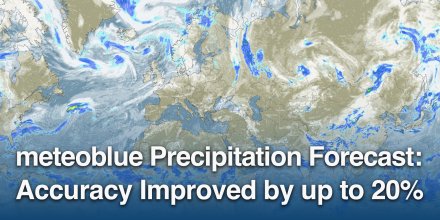
meteoblue Ad-free 9 €
Icon
Clear, cloudless sky
Clear with few low clouds
Mixed with some thunderstorm clouds possible
Clear with few low clouds
Clear but hazy
Temperature (°F)
67°
67°
66°
66°
72°
72°
81°
81°
83°
83°
81°
81°
74°
74°
71°
71°
Temperature felt (°F)
66°
64°
72°
82°
85°
79°
76°
74°
Wind direction
W
WNW
WNW
SE
SE
SSE
S
SW
Wind speed (mph)
W
4-7
4-7
WNW
3-7
3-7
WNW
1-7
1-7
SE
8-14
8-14
SE
10-19
10-19
SSE
13-19
13-19
S
7-14
7-14
SW
5-8
5-8
Precipitation (in/3h)
-
0%
-
-
0%
-
-
0%
-
-
0%
-
-
0%
-
-
0%
-
-
0%
-
-
0%
-
Precipitation probability
0%
0%
0%
0%
0%
0%
0%
0%
Precipitation hourly

00:00 to 01:00:
0% chance of precipitation in the area.
0″ are predicted by our local models.

01:00 to 02:00:
0% chance of precipitation in the area.
0″ are predicted by our local models.

02:00 to 03:00:
0% chance of precipitation in the area.
0″ are predicted by our local models.

03:00 to 04:00:
0% chance of precipitation in the area.
0″ are predicted by our local models.

04:00 to 05:00:
0% chance of precipitation in the area.
0″ are predicted by our local models.

05:00 to 06:00:
0% chance of precipitation in the area.
0″ are predicted by our local models.

06:00 to 07:00:
0% chance of precipitation in the area.
0″ are predicted by our local models.

07:00 to 08:00:
0% chance of precipitation in the area.
0″ are predicted by our local models.

08:00 to 09:00:
0% chance of precipitation in the area.
0″ are predicted by our local models.

09:00 to 10:00:
0% chance of precipitation in the area.
0″ are predicted by our local models.

10:00 to 11:00:
0% chance of precipitation in the area.
0″ are predicted by our local models.

11:00 to 12:00:
0% chance of precipitation in the area.
0″ are predicted by our local models.

12:00 to 13:00:
0% chance of precipitation in the area.
0″ are predicted by our local models.

13:00 to 14:00:
0% chance of precipitation in the area.
0″ are predicted by our local models.

14:00 to 15:00:
0% chance of precipitation in the area.
0″ are predicted by our local models.

15:00 to 16:00:
0% chance of precipitation in the area.
0″ are predicted by our local models.

16:00 to 17:00:
0% chance of precipitation in the area.
0″ are predicted by our local models.

17:00 to 18:00:
0% chance of precipitation in the area.
0″ are predicted by our local models.

18:00 to 19:00:
0% chance of precipitation in the area.
0″ are predicted by our local models.

19:00 to 20:00:
0% chance of precipitation in the area.
0″ are predicted by our local models.

20:00 to 21:00:
0% chance of precipitation in the area.
0″ are predicted by our local models.

21:00 to 22:00:
0% chance of precipitation in the area.
0″ are predicted by our local models.

22:00 to 23:00:
0% chance of precipitation in the area.
0″ are predicted by our local models.

23:00 to 00:00:
0% chance of precipitation in the area.
0″ are predicted by our local models.

Precipitation hourly

No precipitation expected

rainSPOT Precipitation distribution within 20 km
1h view
Hourly view
The weather forecast has very high predictability. Compare different forecasts with MultiModel.

Weather report for Sant Rafel del Maestrat

During the night and in the first hours of the day clear skies prevail, but after noon a few clouds are expected. It is a sunny day. Temperatures peaking at 83 °F. With UV-Index rising to 7, sun protection is strongly recommended. Overnight into Wednesday blows a light breeze (4 to 8 mph). Early in the day a gentle breeze is expected (8 to 12 mph). Wednesday afternoon expect a moderate breeze (12 to 18 mph). Winds blowing overnight from West, in the morning from Southeast and during the afternoon from South. The weather forecast for Sant Rafel del Maestrat for Wednesday is expected to be very accurate.

sun-icon
UV 7
07:26
20:29
Waxing gibbous moon (127°)
18:18
02:12

Pressure: 1015 hPa

Timezone: CEST (UTC +02:00h)

Official severe weather warnings

Aviso de tormentas de nivel amarillo. Litoral norte de Castellón
Moderate
Upcoming
From Tomorrow 14:00 (1 day from now)
Until Tomorrow 23:59 (1 day from now)
Moderate thunderstorm warning. Litoral norte de Castellón
Moderate
Upcoming
From Tomorrow 14:00 (1 day from now)
Until Tomorrow 23:59 (1 day from now)
Last update:
Language:
Aviso de lluvias de nivel amarillo. Litoral norte de Castellón
Moderate
Upcoming
From Tomorrow 14:00 (1 day from now)
Until Tomorrow 23:59 (1 day from now)
Moderate rain warning. Litoral norte de Castellón
Moderate
Upcoming
From Tomorrow 14:00 (1 day from now)
Until Tomorrow 23:59 (1 day from now)
Last update:
Language:

Hourly weather forecast for Sant Rafel del Maestrat

Our 5-day meteogram for Sant Rafel del Maestrat offers all weather information in 3 simple graphs: [More]
  • Temperature chart with weather pictograms. The yellow background indicates daylight.
  • Clouds in different altitudes: from few clouds (light grey) to overcast (dark grey). Dark blue bars show hourly precipitation and light blue showers. An asterisk indicates snow fall.
  • Forecasts for wind speeds are blue and for gusts are green. The arrowheads point in the same direction as the wind.

Live satellite map, Spain

The location marker is placed on Sant Rafel del Maestrat. [More]

The real-time satellite image combines visible light during daytime with infrared radiation during nighttime. At night, the image is not dark as infrared radiation can detect temperature differences. Unfortunately, low clouds and fog are difficult to distinguish from ground temperatures and thus can be almost invisible during the night. Meteosat satellite images for Europe are updated in real-time every 5 minutes. GOES-16/GOES-17 (North & South America) and Himawari (Asia) images update every 10 minutes.

Precipitation is estimated from radar and satellites. Precipitation estimates from satellites are less accurate at night than during daytime.

© 2025 meteoblue, NOAA Satellites GOES-16 and EUMETSAT. Lightning data provided by nowcast.

Radar and precipitation nowcast, Spain

Drizzle
Light
Moderate
Heavy
Very Heavy
Hail

The location marker is placed on Sant Rafel del Maestrat. This animation shows the precipitation radar for the selected time range, as well as a 2h forecast. Orange crosses indicate lightning. Data provided by nowcast.de (available in USA, Europe, Australia). Drizzle or light snow fall might be invisible for the radar. Precipitation intensity is colour coded, ranging from turquoise to red.

Back to top
×
Hey there,
seems like you are using an ad blocker.

Advertising is essential to maintain our free website with unique detail and accuracy.

Please whitelist www.meteoblue.com on your ad blocker or consider buying one of our products:

Already have a subscription?
Then please login.