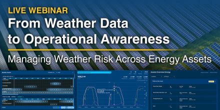
AD FREE

Remove ads for 9 € per year
- 3h
3-hourly view
3h 1h
Icon
Mostly cloudy and few cirrus
Mixed with snow showers
Clear with few low clouds
Overcast
Overcast
Partly cloudy
Clear with few low clouds
°F
23°
20°
24°
28°
29°
29°
23°
19°
°F
12°
12°
15°
15°
11°
NW
WNW
WNW
W
W
W
WSW
SSW
mph
16-31
18-31
19-33
18-34
18-33
14-33
2-13
3-8
in
-
< 0.04
< 0.04
-
-
-
-
-
%
25%
65%
60%
5%
5%
10%
10%
10%
in

00:00 to 01:00:
5% chance of precipitation in the area.
0″ are predicted by our local models.

01:00 to 02:00:
10% chance of precipitation in the area.
0″ are predicted by our local models.

02:00 to 03:00:
25% chance of precipitation in the area.
0″ are predicted by our local models.

03:00 to 04:00:
45% chance of precipitation in the area.
0.02″ are predicted by our local models.

04:00 to 05:00:
65% chance of precipitation in the area.
0″ are predicted by our local models.

05:00 to 06:00:
65% chance of precipitation in the area.
0.01″ are predicted by our local models.

06:00 to 07:00:
60% chance of precipitation in the area.
0.01″ are predicted by our local models.

07:00 to 08:00:
50% chance of precipitation in the area.
0″ are predicted by our local models.

08:00 to 09:00:
25% chance of precipitation in the area.
0″ are predicted by our local models.

09:00 to 10:00:
5% chance of precipitation in the area.
0″ are predicted by our local models.

10:00 to 11:00:
0% chance of precipitation in the area.
0″ are predicted by our local models.

11:00 to 12:00:
0% chance of precipitation in the area.
0″ are predicted by our local models.

12:00 to 13:00:
0% chance of precipitation in the area.
0″ are predicted by our local models.

13:00 to 14:00:
5% chance of precipitation in the area.
0″ are predicted by our local models.

14:00 to 15:00:
5% chance of precipitation in the area.
0″ are predicted by our local models.

15:00 to 16:00:
10% chance of precipitation in the area.
0″ are predicted by our local models.

16:00 to 17:00:
10% chance of precipitation in the area.
0″ are predicted by our local models.

17:00 to 18:00:
10% chance of precipitation in the area.
0″ are predicted by our local models.

18:00 to 19:00:
10% chance of precipitation in the area.
0″ are predicted by our local models.

19:00 to 20:00:
10% chance of precipitation in the area.
0″ are predicted by our local models.

20:00 to 21:00:
10% chance of precipitation in the area.
0″ are predicted by our local models.

21:00 to 22:00:
10% chance of precipitation in the area.
0″ are predicted by our local models.

22:00 to 23:00:
10% chance of precipitation in the area.
0″ are predicted by our local models.

23:00 to 00:00:
10% chance of precipitation in the area.
0″ are predicted by our local models.

12.4 mi
Mostly cloudy and few cirrus
Mixed with snow showers
Clear with few low clouds
Overcast
Overcast
Partly cloudy
Clear with few low clouds
23°
20°
24°
28°
29°
29°
23°
19°
12°
12°
15°
15°
11°
NW
16-31
WNW
18-31
WNW
19-33
W
18-34
W
18-33
W
14-33
WSW
2-13
SSW
3-8
-
25%
< 0.04 in
65%
< 0.04 in
60%
-
5%
-
5%
-
10%
-
10%
-
10%
The weather forecast has medium predictability. Compare different forecasts with MultiModel.

Weather report for Talali

Overnight into Wednesday the weather is changing with a mix of clear and cloudy skies and a chance of snow. Early in the day it will clear up until only a few clouds remain. Wednesday afternoon the sky remains overcast. The sun will not be visible. Temperature highs are likely to reach 30 °F. Overnight into Wednesday expect a moderate breeze (12 to 18 mph). At daytime blows a fresh breeze (18 to 25 mph). From time to time gusts could reach up to 35 mph. Winds blowing overnight from Northwest and by day from West. The weather forecast for Talali for Wednesday can be accurate in parts but deviations are expected. Check again for latest updates.

sun-icon
UV 3
06:04
19:04
Waxing gibbous moon (173°)
18:19
05:37

Pressure: 1008 hPa

Timezone: GMT+09 (UTC +09:00h)

Official severe weather warnings

Wind
Moderate weather warning
Now
From Tuesday 21:00 (12 hours ago)
Until Today 21:00 (11 hours from now)
Ветер
Moderate weather warning
Now
From Tuesday 21:00 (12 hours ago)
Until Today 21:00 (11 hours from now)

Weather radar, Russia

Drizzle
Light
Moderate
Heavy
Very Heavy
Hail

The location marker is placed on Talali. Orange crosses indicate lightning. Data provided by nowcast.de (available in USA, Europe, Australia). Drizzle or light snow fall might be invisible for the radar. Precipitation intensity is colour coded, ranging from turquoise to red.

Hourly weather forecast for Talali

Our 5-day meteogram for Talali offers all weather information in 3 simple graphs: [More]
  • Temperature chart with weather pictograms. The yellow background indicates daylight.
  • Clouds in different altitudes: from few clouds (light grey) to overcast (dark grey). Dark blue bars show hourly precipitation and light blue showers. An asterisk indicates snow fall.
  • Forecasts for wind speeds are blue and for gusts are green. The arrowheads point in the same direction as the wind.

You can embed this meteogram into your own website. Customize it here.

Live satellite map, Russia

The location marker is placed on Talali. [More]

The real-time satellite image combines visible light during daytime with infrared radiation during nighttime. At night, the image is not dark as infrared radiation can detect temperature differences. Unfortunately, low clouds and fog are difficult to distinguish from ground temperatures and thus can be almost invisible during the night. Meteosat satellite images for Europe are updated in real-time every 5 minutes. GOES-16/GOES-17 (North & South America) and Himawari (Asia) images update every 10 minutes.

Precipitation is estimated from radar and satellites. Precipitation estimates from satellites are less accurate at night than during daytime.

© 2026 meteoblue, NOAA Satellites GOES-16 and EUMETSAT. Lightning data provided by nowcast.

Back to top
×
Hey there,
seems like you are using an ad blocker.

Advertising is essential to maintain our free website with unique detail and accuracy.

Please whitelist www.meteoblue.com on your ad blocker or consider buying one of our products:

Already have a subscription?
Then please login.