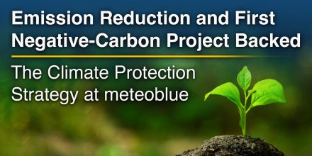
AD FREE

Remove ads for 9 € per year
- 3h
3-hourly view
3h 1h
Icon
Fog/low stratus clouds with few cirrus
Clear but hazy with few cirrus
Clear, cloudless sky
Clear with few low clouds and few cirrus
Light rain, thunderstorms likely
Overcast
Mixed with cirrus with some thunderstorm clouds possible
°F
69°
69°
78°
86°
86°
78°
73°
71°
°F
76°
75°
85°
99°
92°
85°
82°
79°
ESE
E
E
NW
WNW
WNW
WNW
SE
mph
1-3
2-4
2-6
1-8
5-11
4-11
1-5
1-3
in
-
-
-
-
-
0.05
-
-
%
10%
5%
0%
0%
25%
40%
30%
20%
in

00:00 to 01:00:
10% chance of precipitation in the area.
0″ are predicted by our local models.

01:00 to 02:00:
10% chance of precipitation in the area.
0″ are predicted by our local models.

02:00 to 03:00:
10% chance of precipitation in the area.
0″ are predicted by our local models.

03:00 to 04:00:
5% chance of precipitation in the area.
0″ are predicted by our local models.

04:00 to 05:00:
5% chance of precipitation in the area.
0″ are predicted by our local models.

05:00 to 06:00:
0% chance of precipitation in the area.
0″ are predicted by our local models.

06:00 to 07:00:
0% chance of precipitation in the area.
0″ are predicted by our local models.

07:00 to 08:00:
0% chance of precipitation in the area.
0″ are predicted by our local models.

08:00 to 09:00:
0% chance of precipitation in the area.
0″ are predicted by our local models.

09:00 to 10:00:
0% chance of precipitation in the area.
0″ are predicted by our local models.

10:00 to 11:00:
0% chance of precipitation in the area.
0″ are predicted by our local models.

11:00 to 12:00:
0% chance of precipitation in the area.
0″ are predicted by our local models.

12:00 to 13:00:
0% chance of precipitation in the area.
0″ are predicted by our local models.

13:00 to 14:00:
10% chance of precipitation in the area.
0″ are predicted by our local models.

14:00 to 15:00:
25% chance of precipitation in the area.
0″ are predicted by our local models.

15:00 to 16:00:
35% chance of precipitation in the area.
0″ are predicted by our local models.

16:00 to 17:00:
40% chance of precipitation in the area.
0.05″ are predicted by our local models.

17:00 to 18:00:
35% chance of precipitation in the area.
0″ are predicted by our local models.

18:00 to 19:00:
30% chance of precipitation in the area.
0″ are predicted by our local models.

19:00 to 20:00:
25% chance of precipitation in the area.
0″ are predicted by our local models.

20:00 to 21:00:
20% chance of precipitation in the area.
0″ are predicted by our local models.

21:00 to 22:00:
20% chance of precipitation in the area.
0″ are predicted by our local models.

22:00 to 23:00:
20% chance of precipitation in the area.
0″ are predicted by our local models.

23:00 to 00:00:
20% chance of precipitation in the area.
0″ are predicted by our local models.

12.4 mi
Fog/low stratus clouds with few cirrus
Clear but hazy with few cirrus
Clear, cloudless sky
Clear with few low clouds and few cirrus
Light rain, thunderstorms likely
Overcast
Mixed with cirrus with some thunderstorm clouds possible
69°
69°
78°
86°
86°
78°
73°
71°
76°
75°
85°
99°
92°
85°
82°
79°
ESE
1-3
E
2-4
E
2-6
NW
1-8
WNW
5-11
WNW
4-11
WNW
1-5
SE
1-3
-
10%
-
5%
-
0%
-
0%
-
25%
0.05 in
40%
-
30%
-
20%
The weather forecast has medium predictability. Compare different forecasts with MultiModel.

Weather report for Victorino

Overnight into Tuesday a few clouds are expected, the sky clears on Tuesday morning. In the afternoon there is a chance of thunderstorms and local showers. It is a sunny day. The forecast has a moderate, 40% chance of Precipitation. Temperature highs are likely to reach 88 °F. The UV-Index climbs up to 10, don't forget to use sunscreen when spending the day outside. During the night and in the morning light air is noticeable (1 to 4 mph). For the afternoon blows a light breeze (4 to 8 mph). Winds blowing at night and in the morning from East and during the afternoon from West. The weather forecast for Victorino for Tuesday can be accurate in parts but deviations are expected. Check again for latest updates.

sun-icon
UV 10
06:09
17:52
Waxing gibbous moon (143°)
15:42
03:23

Pressure: 1011 hPa

Timezone: WAT (UTC +01:00h)

Weather radar, Angola

Drizzle
Light
Moderate
Heavy
Very Heavy
Hail

The location marker is placed on Victorino. Orange crosses indicate lightning. Data provided by nowcast.de (available in USA, Europe, Australia). Drizzle or light snow fall might be invisible for the radar. Precipitation intensity is colour coded, ranging from turquoise to red.

Hourly weather forecast for Victorino

Our 5-day meteogram for Victorino offers all weather information in 3 simple graphs: [More]
  • Temperature chart with weather pictograms. The yellow background indicates daylight.
  • Clouds in different altitudes: from few clouds (light grey) to overcast (dark grey). Dark blue bars show hourly precipitation and light blue showers. An asterisk indicates snow fall.
  • Forecasts for wind speeds are blue and for gusts are green. The arrowheads point in the same direction as the wind.

You can embed this meteogram into your own website. Customize it here.

Live satellite map, Angola

The location marker is placed on Victorino. [More]

The real-time satellite image combines visible light during daytime with infrared radiation during nighttime. At night, the image is not dark as infrared radiation can detect temperature differences. Unfortunately, low clouds and fog are difficult to distinguish from ground temperatures and thus can be almost invisible during the night. Meteosat satellite images for Europe are updated in real-time every 5 minutes. GOES-16/GOES-17 (North & South America) and Himawari (Asia) images update every 10 minutes.

Precipitation is estimated from radar and satellites. Precipitation estimates from satellites are less accurate at night than during daytime.

© 2026 meteoblue, NOAA Satellites GOES-16 and EUMETSAT. Lightning data provided by nowcast.

Back to top
×
Hey there,
seems like you are using an ad blocker.

Advertising is essential to maintain our free website with unique detail and accuracy.

Please whitelist www.meteoblue.com on your ad blocker or consider buying one of our products:

Already have a subscription?
Then please login.