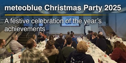
meteoblue Ad-free 9 €
Icon
Mixed with few cirrus with some thunderstorm clouds possible
Clear, cloudless sky
Mixed with some thunderstorm clouds possible
Clear with few low clouds
Mixed with some thunderstorm clouds possible
Clear with few low clouds
Clear with few low clouds and cirrus
Temperature (°F)
67°
67°
66°
66°
74°
74°
82°
82°
89°
89°
88°
88°
82°
82°
75°
75°
Temperature felt (°F)
70°
66°
75°
86°
94°
88°
81°
74°
Wind direction
W
WNW
NNW
N
NNE
E
ENE
E
Wind speed (mph)
W
2-7
2-7
WNW
3-5
3-5
NNW
4-5
4-5
N
3-6
3-6
NNE
3-7
3-7
E
7-8
7-8
ENE
7-9
7-9
E
9-13
9-13
Precipitation (in/3h)
-
5%
-
-
0%
-
-
5%
-
-
20%
-
-
0%
-
-
5%
-
-
5%
-
-
20%
-
Precipitation probability
5%
0%
5%
20%
0%
5%
5%
20%
Precipitation hourly

00:00 to 01:00:
5% chance of precipitation in the area.
0″ are predicted by our local models.

01:00 to 02:00:
0% chance of precipitation in the area.
0″ are predicted by our local models.

02:00 to 03:00:
0% chance of precipitation in the area.
0″ are predicted by our local models.

03:00 to 04:00:
0% chance of precipitation in the area.
0″ are predicted by our local models.

04:00 to 05:00:
0% chance of precipitation in the area.
0″ are predicted by our local models.

05:00 to 06:00:
0% chance of precipitation in the area.
0″ are predicted by our local models.

06:00 to 07:00:
0% chance of precipitation in the area.
0″ are predicted by our local models.

07:00 to 08:00:
5% chance of precipitation in the area.
0″ are predicted by our local models.

08:00 to 09:00:
5% chance of precipitation in the area.
0″ are predicted by our local models.

09:00 to 10:00:
10% chance of precipitation in the area.
0″ are predicted by our local models.

10:00 to 11:00:
20% chance of precipitation in the area.
0″ are predicted by our local models.

11:00 to 12:00:
0% chance of precipitation in the area.
0″ are predicted by our local models.

12:00 to 13:00:
0% chance of precipitation in the area.
0″ are predicted by our local models.

13:00 to 14:00:
0% chance of precipitation in the area.
0″ are predicted by our local models.

14:00 to 15:00:
0% chance of precipitation in the area.
0″ are predicted by our local models.

15:00 to 16:00:
0% chance of precipitation in the area.
0″ are predicted by our local models.

16:00 to 17:00:
0% chance of precipitation in the area.
0″ are predicted by our local models.

17:00 to 18:00:
5% chance of precipitation in the area.
0″ are predicted by our local models.

18:00 to 19:00:
5% chance of precipitation in the area.
0″ are predicted by our local models.

19:00 to 20:00:
5% chance of precipitation in the area.
0″ are predicted by our local models.

20:00 to 21:00:
0% chance of precipitation in the area.
0″ are predicted by our local models.

21:00 to 22:00:
0% chance of precipitation in the area.
0″ are predicted by our local models.

22:00 to 23:00:
20% chance of precipitation in the area.
0″ are predicted by our local models.

23:00 to 00:00:
15% chance of precipitation in the area.
0″ are predicted by our local models.

rainSPOT Precipitation distribution within 20 km
1h view
Hourly view
The weather forecast has high predictability. Compare different forecasts with MultiModel.

Weather report for Zundert

On Friday a few clouds are expected. It is a sunny day. Temperatures peaking at 89 °F. With UV-Index rising to 7, sun protection is strongly recommended. Until noon blows a light breeze (4 to 8 mph). Friday afternoon a gentle breeze is expected (8 to 12 mph). Winds blowing overnight from Southeast, in the morning from Northwest and during the afternoon from East. The weather forecast for Zundert for Friday is likely to be accurate.

sun-icon
UV 7
05:21
22:01
Waning gibbous moon (205°)
----
06:31

Pressure: 1017 hPa

Timezone: CEST (UTC +02:00h)

Official severe weather warnings

Onweersbuien - Waarschuwingen voor Noord-Brabant - Nederland
Moderate
Upcoming
From Tomorrow 21:00 (1 day from now)
Until Saturday 01:00 (1 day from now)
Thunderstorm - Warnings for Noord-Brabant - The Netherlands
Moderate
Upcoming
From Tomorrow 21:00 (1 day from now)
Until Saturday 01:00 (1 day from now)
Last update:
Language:
Groene waarschuwing voor hittegolf in België - Antwerpen
Moderate
Now
From Today 11:05 (6 hours ago)
Until Saturday 00:00 (1 day from now)
Avertissement verte vague de chaleur en Belgique - Anvers
Moderate
Now
From Today 11:05 (6 hours ago)
Until Saturday 00:00 (1 day from now)
Green warning for heatwave in Belgium - Antwerp
Moderate
Now
From Today 11:05 (6 hours ago)
Until Saturday 00:00 (1 day from now)
Grüne Warnung fur heisse in Belgien - Antwerpen
Moderate
Now
From Today 11:05 (6 hours ago)
Until Saturday 00:00 (1 day from now)
Last update:
Language:

Extreme weather: Unusually hot weather for the season

Extremely cold
Unusually cold
Normal
Unusually warm
Extremely warm

By comparing today's temperatures to 40 years of historical data we can see whether today's forecast is unusually warm (red areas) or cold (blue areas). Coloured dots show observed actual temperatures from professional and private weather stations.

More Weather Maps

Radar and precipitation nowcast, The Netherlands

Drizzle
Light
Moderate
Heavy
Very Heavy
Hail

The location marker is placed on Zundert. This animation shows the precipitation radar for the selected time range, as well as a 2h forecast. Orange crosses indicate lightning. Data provided by nowcast.de (available in USA, Europe, Australia). Drizzle or light snow fall might be invisible for the radar. Precipitation intensity is colour coded, ranging from turquoise to red.

Hourly weather forecast for Zundert

Our 5-day meteogram for Zundert offers all weather information in 3 simple graphs: [More]
  • Temperature chart with weather pictograms. The yellow background indicates daylight.
  • Clouds in different altitudes: from few clouds (light grey) to overcast (dark grey). Dark blue bars show hourly precipitation and light blue showers. An asterisk indicates snow fall.
  • Forecasts for wind speeds are blue and for gusts are green. The arrowheads point in the same direction as the wind.

Live satellite map, The Netherlands

The location marker is placed on Zundert. [More]

The real-time satellite image combines visible light during daytime with infrared radiation during nighttime. At night, the image is not dark as infrared radiation can detect temperature differences. Unfortunately, low clouds and fog are difficult to distinguish from ground temperatures and thus can be almost invisible during the night. Meteosat satellite images for Europe are updated in real-time every 5 minutes. GOES-16/GOES-17 (North & South America) and Himawari (Asia) images update every 10 minutes.

Precipitation is estimated from radar and satellites. Precipitation estimates from satellites are less accurate at night than during daytime.

© 2025 meteoblue, NOAA Satellites GOES-16 and EUMETSAT. Lightning data provided by nowcast.

Back to top
×
Hey there,
seems like you are using an ad blocker.

Advertising is essential to maintain our free website with unique detail and accuracy.

Please whitelist www.meteoblue.com on your ad blocker or consider buying one of our products:

Already have a subscription?
Then please login.