A southwesterly airflow is responsible for the hot temperatures in the second July weekend, arriving in Switzerland on Friday. This will lead to high temperatures in most parts of Europe. Since warm air can absorb more moisture, hot and humid conditions are also expected, which can cause the perceived temperature to be significantly higher than the actual air temperature.
This weather situation will also bring high temperatures to the Swiss city Zurich. The expected air temperatures in the city can vary a lot due to the urban heat island effect.
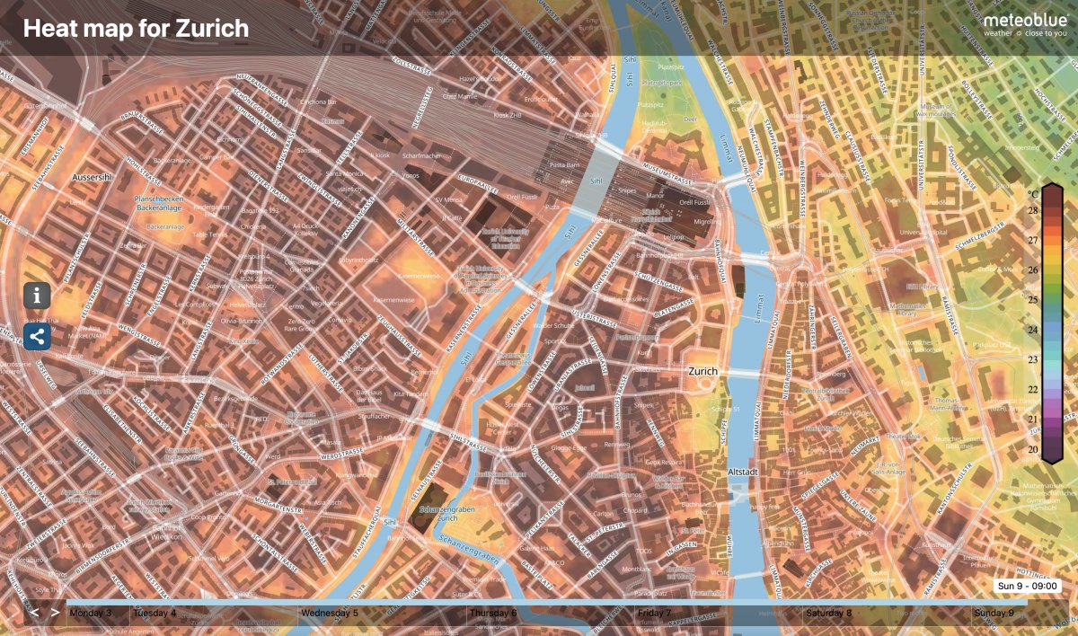
You can track local temperatures with a resolution of 10x10m with our heat maps available for 80 cities around the globe – and for Zurich, you can even access a 72h forecast.
This forecast is based on our MultiModel temperature forecast data, which considers more than 20 weather models for Zurich with a spatial resolution between 2 and 30km. We then applied MOS (Model Output Statistics) techniques to downscale the forecast based on high-resolution satellite data, achieving a 10x10m resolution. With this approach, the meteoblue city climate model (mCCM) can also forecast hyper-local temperature differences in the city, such as the above-mentioned urban heat island phenomenon.
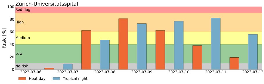
In the last year, we have developed a heatwave alerting system that shows the likelihood of several climate indices such as hot days (maximum daily temperature > 30°C) or tropical nights (minimum daily temperature > 20°C) up to 6 days ahead. Cities are using this alerting system for their critical infrastructure (such as hospitals or kindergarden) and to plan heat measures such as ventilating at the correct times, refraining from physically strenuous activities whenever possible, or monitoring patients' fluid intake.
The map below shows the heat map for Zurich and highlights 3 selected points within the city that we analysed in more depth for Saturday 8.7.2023 [21:00 CEST].
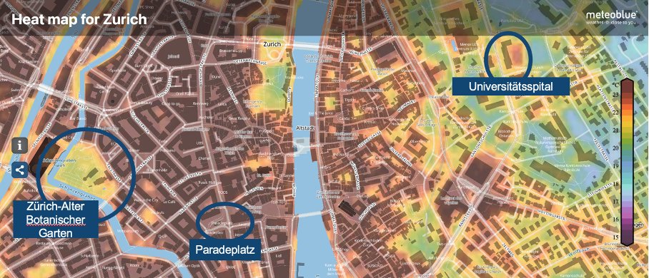
The temperatures in the botanical garden are lower compared to Paradeplatz, and consequently, the risk for tropical nights is higher at the selected point. This is also visualised in the meteogram, where the blue bars show the likelihood of tropical nights. This effect is caused called the “urban heat island effect” because the buildings surrounding Paradeplatz have a higher heat capacity meaning that they store the heat during the day and release the heat during night.