News

Tell us how you perceive meteoblue
Help us understand how you perceive meteoblue so that we can improve our communication in a targeted way.
Read on

Help us understand how you perceive meteoblue so that we can improve our communication in a targeted way.
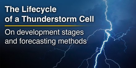
Few weather phenomena evolve as rapidly as a thunderstorm. A calm summer afternoon can quickly turn into heavy rain, lightning, hail, and strong winds within less than an hour. What begins as an ordinary cumulus cloud may grow into a towering storm reaching more than 10 kilometres in height. Despite their short lifespan, thunderstorms are among the atmosphere's most dynamic weather systems.
|
|
|
|
|
|
|
|
||
|
Icon
|
|
|
|
|
|
|
|
|
|
°F
|
46°
|
46°
|
47°
|
47°
|
48°
|
48°
|
47°
|
45°
|
|
°F
|
41°
|
41°
|
41°
|
41°
|
40°
|
41°
|
41°
|
40°
|
|
|
NNE |
NE |
NE |
ENE |
E |
E |
ESE |
E |
|
mph
|
6-10
|
5-9
|
6-9
|
5-13
|
7-17
|
6-18
|
5-13
|
4-6
|
|
in
|
-
|
-
|
-
|
-
|
-
|
-
|
-
|
-
|
|
%
|
5%
|
20%
|
30%
|
40%
|
45%
|
25%
|
0%
|
0%
|
|
in
|
||||||||
|
12.4 mi
|
Night and day the sky remains overcast. The sun will not be visible. The forecast has a moderate, 40% chance of Precipitation. Temperatures peaking at 48 °F. On Friday blows a light breeze (4 to 8 mph). From time to time gusts could reach up to 18 mph. Winds blowing at night and in the morning from Northeast and during the afternoon from East. The weather forecast for Reykjavik for Friday is likely to be accurate.

Pressure: 1008 hPa
Timezone: GMT
The location marker is placed on Reykjavik. This animation shows the precipitation radar for the selected time range, as well as a 2h forecast. Orange crosses indicate lightning. Data provided by nowcast.de (available in USA, Europe, Australia). Drizzle or light snow fall might be invisible for the radar. Precipitation intensity is colour coded, ranging from turquoise to red.
You can embed this meteogram into your own website. Customize it here.
The real-time satellite image combines visible light during daytime with infrared radiation during nighttime. At night, the image is not dark as infrared radiation can detect temperature differences. Unfortunately, low clouds and fog are difficult to distinguish from ground temperatures and thus can be almost invisible during the night. Meteosat satellite images for Europe are updated in real-time every 5 minutes. GOES-16/GOES-17 (North & South America) and Himawari (Asia) images update every 10 minutes.
Precipitation is estimated from radar and satellites. Precipitation estimates from satellites are less accurate at night than during daytime.
© 2026 meteoblue, NOAA Satellites GOES-16 and EUMETSAT. Lightning data provided by nowcast.
Help us understand how you perceive meteoblue so that we can improve our communication in a targeted way.
Few weather phenomena evolve as rapidly as a thunderstorm. A calm summer afternoon can quickly turn into heavy rain, lightning, hail, and strong winds within less than an hour. What begins as an ordinary cumulus cloud may grow into a towering storm reaching more than 10 kilometres in height. Despite their short lifespan, thunderstorms are among the atmosphere's most dynamic weather systems.
Advertising is essential to maintain our free website with unique detail and accuracy.
Please whitelist www.meteoblue.com on your ad blocker or consider buying one of our products:
Already have a subscription?
Then please login.


 Keflavik


