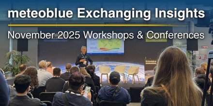
Comprehensive Climate Risk Assessment - Now at Your Fingertips with climate+
Make informed decisions with location-specific Climate Risk Reports, available within minutes.
Urban areas experience more intense heat due to dense infrastructure and limited green space.
|
|||||||||
---|---|---|---|---|---|---|---|---|---|
Icon
|
|
|
|
|
|
|
|
|
|
Temperature (°F)
|
|||||||||
Temperature felt (°F)
|
87° |
83° |
94° |
111° |
118° |
115° |
106° |
97° |
|
Wind direction
|
NW |
NW |
WNW |
WNW |
WNW |
WNW |
WNW |
WNW |
|
Wind speed (mph)
|
NW
8-15
8-15
|
NW
5-12
5-12
|
WNW
9-15
9-15
|
WNW
12-20
12-20
|
WNW
13-20
13-20
|
WNW
15-23
15-23
|
WNW
8-17
8-17
|
WNW
8-13
8-13
|
|
Desert dust concentration
|
|||||||||
Precipitation (in/3h)
|
-
0%
-
|
-
0%
-
|
-
0%
-
|
-
0%
-
|
-
0%
-
|
-
0%
-
|
-
0%
-
|
-
0%
-
|
|
Precipitation probability
|
0%
|
0%
|
0%
|
0%
|
0%
|
0%
|
0%
|
0%
|
|
Precipitation hourly
|
|||||||||
Precipitation hourly
|
No precipitation expected |
||||||||
rainSPOT
Precipitation distribution within 20 km
|
|
Overnight into Wednesday a few clouds are expected, the sky clears during the day. It is a sunny day. Temperatures peaking at 118 °F. The UV-Index climbs up to 9, don't forget to use sunscreen when spending the day outside. Overnight into Wednesday a gentle breeze is expected (8 to 12 mph). During the day expect a moderate breeze (12 to 18 mph). Winds blowing at night and in the afternoon from Northwest and in the morning from West. The weather forecast for Shahrak-e Shahīd Chamrān for Wednesday is expected to be very accurate.
Pressure: 993 hPa
Timezone: GMT+0330 (UTC +03:30h)
The real-time satellite image combines visible light during daytime with infrared radiation during nighttime. At night, the image is not dark as infrared radiation can detect temperature differences. Unfortunately, low clouds and fog are difficult to distinguish from ground temperatures and thus can be almost invisible during the night. Meteosat satellite images for Europe are updated in real-time every 5 minutes. GOES-16/GOES-17 (North & South America) and Himawari (Asia) images update every 10 minutes.
Precipitation is estimated from radar and satellites. Precipitation estimates from satellites are less accurate at night than during daytime.
© 2025 meteoblue, NOAA Satellites GOES-16 and EUMETSAT. Lightning data provided by nowcast.
The location marker is placed on Shahrak-e Shahīd Chamrān. This animation shows the precipitation radar for the selected time range, as well as a 2h forecast. Orange crosses indicate lightning. Data provided by nowcast.de (available in USA, Europe, Australia). Drizzle or light snow fall might be invisible for the radar. Precipitation intensity is colour coded, ranging from turquoise to red.
Make informed decisions with location-specific Climate Risk Reports, available within minutes.
Urban areas experience more intense heat due to dense infrastructure and limited green space.
Advertising is essential to maintain our free website with unique detail and accuracy.
Please whitelist www.meteoblue.com on your ad blocker or consider buying one of our products:
Already have a subscription?
Then please login.